
Last Updated: October 29, 2026
Quick Summary
Digital cartography keeps historical maps usable by digitizing them, georeferencing them to modern coordinates, and storing them with standards-based metadata and fixity checks. It also makes them searchable and open to analysis, while recording the error margins that show how far each map can be trusted.
- Scan fragile sheets without pressing them, and document existing tears or losses in the metadata.
- Record the root mean square error of your control points so users know how far to trust the alignment.
- Use uncompressed TIFF as the master format and compute SHA-256 checksums when files are ingested.
- Follow the 3-2-1 rule: three copies, two media types, and one copy stored off-site.
- Consult communities before publishing sensitive locations, and consider restricting precise coordinates of certain sites.
Table of Contents
- What Digital Cartography Means for Historical Maps
- Digitizing and Georeferencing Historical Maps
- Historical GIS Mapping for Spatial Analysis
- Digital Preservation of Historical Maps: File Formats, Metadata and Storage
- Digital Mapping of Historic Landmarks Over Time
- Accuracy, Uncertainty and Community Access
- Planning Your First Digital Map Preservation Project
- Frequently Asked Questions
What Digital Cartography Means for Historical Maps
Digital cartography is the practice of creating, storing and analyzing maps with computer tools, and it has become one of the main ways libraries and archives keep historical maps usable. Readers curious about why maps and geography carry political weight can explore why geography is a political issue, from power and place to identity.
A paper map degrades with light, humidity and handling. A well-made digital copy can outlast the original and be examined at a level of detail no reading room allows.
Digital cartography covers several connected activities: scanning source sheets, matching them to coordinates, layering them in geographic information systems, and publishing them in usable formats. For the wider purpose behind this work, see why historical geography matters today. Each step involves accuracy decisions that should be documented.
Many institutions approach this work through shared standards rather than one-off projects.
Digitizing and Georeferencing Historical Maps
Digitizing a historical map means producing a faithful image of it, and georeferencing means attaching that image to real-world coordinates so it lines up with modern geography. The two steps are linked, because a poor scan makes accurate georeferencing almost impossible.
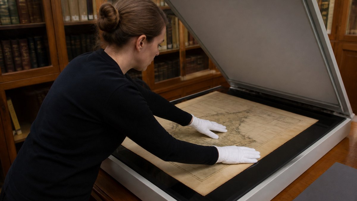
For most projects, a high-resolution scan at a consistent resolution, saved in an uncompressed master format, is the starting point. Color calibration matters more than many expect, since faded inks and foxing can hide the very labels a researcher needs.
Scanning Fragile Sheets Without Damaging Them
Fragile maps need a conservator's mindset before they reach a scanner. Handling should be minimal, and sheets supported along their full extent.
A common mistake is scanning too aggressively, using high pressure or a glass platen that flattens creases into the image. Scan without pressing the paper where possible, and document any existing tears or losses in the metadata.
Matching Old Scales to Modern Coordinates
Georeferencing works by selecting control points, identifiable features such as a river bend, a coastline or a street intersection, that appear on both the historical map and a modern reference layer. The software then transforms the scan so those points align.
Scale is the usual trouble spot. Many historic maps were not drawn to a single consistent scale, and some were schematic. A map that looks precise may still shift several hundred meters when aligned to modern data.
Historical GIS Mapping for Spatial Analysis
Once a map is georeferenced, a geographic information system lets researchers compare it with other sources, measure distances, and track how land use or boundaries changed over time. This is where digital cartography moves from preservation into analysis.
A typical historical GIS project layers several maps from different decades over the same extent, then uses those layers to examine urban growth, the drying of wetlands, or the shift of a town's center.
Core Analytical Methods
Historical GIS supports several concrete analytical techniques beyond simple overlay. Change detection compares two or more georeferenced maps to identify where features have appeared, disappeared, or moved, for example, overlaying a 1900 Sanborn fire insurance map with a modern parcel layer can reveal where buildings were removed for highway construction or urban renewal. Buffer analysis measures how far features are from one another, such as the distance from a historical school to the nearest factory. Network analysis traces historical roads, canals, or rail lines to model travel times and connectivity.
A Worked Example: Mapping Urban Expansion
Consider a project examining the growth of a mid-sized city between 1880 and 1920. The researcher georeferences three maps: an 1880 county atlas, a 1900 Sanborn set, and a 1920 city plan. After aligning each to modern coordinates and recording root mean square errors (typically 10-30 meters for hand-drawn maps of this era), the researcher digitizes building footprints and street centerlines as separate layers.
Common Pitfalls and How to Avoid Them
A frequent mistake is treating historical map features as directly comparable to modern data without accounting for differences in projection, scale, and survey accuracy. Another is ignoring attribute uncertainty: a building marked "store" on an 1880 map may have been a residence with a shop front, and the original cartographer's classification scheme may not match modern land-use categories. Record the original map's legend and any ambiguities, and avoid aggregating features into modern categories without documenting the translation.
Tools and Standards
Most historical GIS work uses desktop GIS software such as QGIS (open source) or ArcGIS, both of which support georeferencing, digitizing, and spatial analysis. For sharing results, the Federal Geographic Data Committee's Geospatial Metadata Standards provide a consistent way to describe datasets, including lineage information that records the source maps and processing steps. When publishing interactive maps online, institutions often use open-source libraries like Leaflet or OpenLayers to display georeferenced historical maps alongside modern base layers.
Digital Preservation of Historical Maps: File Formats, Metadata and Storage
Preservation is the part most projects underfund. A scan that cannot be opened in ten years has not been preserved. Long-term digital preservation requires deliberate choices about formats, metadata, storage, and ongoing maintenance, not just a one-time backup.
Choosing Sustainable File Formats
For images, uncompressed TIFF is a widely used master format because it is well documented, widely supported, and does not discard data. For georeferenced data, formats like GeoPackage (an open, SQLite-based container) or shapefiles with accompanying metadata are common, though shapefiles have limitations (e.g., field name length, no support for Unicode). Standards such as the Federal Geographic Data Committee's geospatial metadata standards are a common starting point for describing datasets. Choose formats that are open, well-documented, and widely supported, and plan for migration before formats become obsolete.
Metadata: More Than a Title
Preservation metadata must record far more than the source map's title and date. A complete record includes technical metadata (scanning resolution, color profile, bit depth, software used), provenance (who scanned it, when, and with what equipment), rights information (copyright status, permissions), and structural metadata (how pages or sheets relate to one another). For georeferenced data, record the control points used, the transformation method (e.g., polynomial, spline), the root mean square error, and the reference layer.
Storage, Fixity, and Migration
Storage should follow the 3-2-1 rule: at least three copies, on two different types of media, with one copy off-site. Many institutions use a combination of spinning disk for active access, tape (LTO) for archival backup, and cloud storage for geographic redundancy. Fixity checks, computing a checksum (e.g., SHA-256) when a file is ingested and re-verifying it on a schedule (quarterly or annually), confirm that files have not silently corrupted. Periodic fixity checks are a common part of a digital preservation program.
A Practical Preservation Checklist
- Ingest: scan to uncompressed TIFF, compute SHA-256 checksums, record technical metadata.
- Store: three copies, two media types, one off-site; document storage locations.
- Describe: complete FGDC or ISO 19115 metadata, including lineage and rights.
- Verify: run fixity checks quarterly; log results and investigate failures.
- Migrate: review formats every three to five years; migrate when formats are deprecated or media reach end-of-life; validate after migration.
The Cost of Neglect
A common pattern is for projects to invest heavily in scanning and georeferencing but neglect ongoing preservation. Files stored on a single hard drive without checksums may degrade silently; metadata written in a spreadsheet may be lost when staff leave. The result is a digital collection that looks complete but is untrustworthy. Budgeting for preservation, staff time for fixity checks, storage costs, and migration planning, is as important as budgeting for digitization.
Digital Mapping of Historic Landmarks Over Time
Digital mapping makes it possible to follow a single landmark across the maps that show it. A ferry crossing, a mill or a church may appear under different names as ownership, language and politics change.
This is where place names become historically significant. To trace landmarks back to their earliest recorded forms, browse original names of US landmarks before the rename. A practical method for checking these names is set out in how to verify historical place names: a genealogist's guide.
Accuracy, Uncertainty and Community Access
Accuracy in historical digital cartography is a matter of stating uncertainty clearly. A georeferenced map should carry its error estimate, and interpretations should separate what the source shows from what the analyst infers.
Access raises its own questions. Some maps depict sacred sites, burial grounds or culturally sensitive locations, and indigenous communities may hold knowledge that conflicts with or complements the archival record. To learn more, see these five learning resources on Indigenous geography.
Planning Your First Digital Map Preservation Project
Start small. Choose a limited set of maps tied to a clear question, such as how a single town's boundaries changed, and define what success looks like before scanning begins.
The rough sequence is: survey the collection and its condition, set scanning and file standards, digitize with calibrated equipment, georeference with recorded error, write metadata as you go, and store copies in at least two locations. Plan staffing realistically, since georeferencing is slow and benefits from a second checker.
| Stage | Main task | Key output |
|---|---|---|
| Survey | Assess condition and select maps | Inventory and handling plan |
| Digitize | Scan to master standard | Uncompressed TIFF masters |
| Georeference | Align to coordinates | Control points and error values |
| Describe | Write metadata | Standards-based records |
| Store | Replicate and check fixity | Redundant, verified copies |
Measure your results. Track how many maps were completed, the average georeferencing error, and how often users access the material. Those numbers show whether the project is working and where to improve.
If you are choosing products that reflect this kind of attention to historical naming, our Corrected Names Tee is priced at $25.00 and printed on 100% ring-spun cotton, with the corrections displayed for anyone who wants a short geography lesson on their chest. You can also explore our Gulf of Mexico - Since 1552 Tee at $25.00, a vintage-style shirt built around one of the most durable names on the map.

Frequently Asked Questions
What is digital cartography?
Digital cartography is the practice of creating, editing, storing and sharing maps using computer software and digital data rather than traditional hand drafting and print. It covers everything from scanning old sheets to building interactive web maps. For historical preservation, its main value is that a fragile paper map can be captured as a high-resolution digital image, described with metadata and linked to modern coordinates, so researchers can study it without handling the original. Institutions such as the Library of Congress publish large digitized map collections that show this approach in practice.
How does digital cartography help preserve historical sites?
Digital cartography lets preservationists record a historic landmark's footprint, boundaries and surroundings as they existed at different points in time. By georeferencing older maps and overlaying them on current GIS layers, teams can document urban encroachment, erosion or land-use change around a site. These records serve as evidence for nomination files, restoration planning and monitoring. The result is a dated, spatially accurate record that survives even if the physical structure is altered or lost.
What challenges come with preserving historical maps digitally?
The main challenges are physical fragility during scanning, inconsistent map projections and scales, incomplete or inaccurate source metadata, and file formats that may become unreadable over time. Georeferencing also introduces uncertainty, because old surveys were rarely as precise as modern GPS coordinates. Good practice is to record the error margin of each georeferenced map, keep archival master files in open formats such as TIFF, and document every transformation step so future users can judge the result.
How can communities use digital mapping to document historic landmarks?
Local historical societies, schools and neighborhood groups can combine old maps, photographs and property records in a shared GIS project to trace how a landmark and its surroundings have changed. Community members can contribute local knowledge, such as where a building stood or a name was used, which official records often omit. Clear permissions and consultation are important when the sites or stories belong to particular families or tribal nations, and sensitive locations may need restricted access rather than public publication.
