
Table of Contents
- Why Historical Place Names Need Verification
- Step 1: Start with the U.S. Geological Survey GNIS database
- Step 2: Cross-Reference with Maps and Gazetteers
- Step 3: How to Track Place Name Changes Over Time
- Step 4: Handle Non-English and Colonial Name Translations
- Genealogy Location Verification in Practice
- Common Mistakes to Avoid in Place Name Research
- Conclusion: Document Your Geographic Evidence
- Frequently Asked Questions
Last Updated: September 8, 2026
Why Historical Place Names Need Verification
A place name is a timestamp. When you find "Moscow" on an 1850 deed or "New Amsterdam" in a ship manifest, that name tells you when the record was created, who created it, and under which government they lived. But it only tells you those things if you verify it. Historical place names are the names applied to locations at specific points in time, and they shift with border changes, colonial administration, and political fashion.
Treating a modern name as if it applied historically corrupts your research. If you search for records using today's county lines or city limits, you will miss the records filed under the old jurisdiction. The gap between what a place was called and what it is called now is where genealogical dead ends live.
Verification is a skill you can learn. The process below walks through the major databases, mapping tools, and documentation habits that separate solid research from guesswork.
Step 1: Start with the U.S. Geological Survey GNIS database
The U.S. Geological Survey GNIS database is the federal government's official registry of place names, and it is always your first stop. It contains entries for nearly every named feature in the country, along with their official names and geographic coordinates. To use it effectively for historical research, you need to understand its structure beyond a simple name search.
GNIS is not a single flat list. Each feature is assigned a unique Feature ID and a Feature Class (e.g., "Populated Place," "Locale," "Civil," "Summit"). For historical research, the most valuable classes are often "Populated Place" and "Locale," because many vanished settlements are classified as "Locale" and will not appear on modern maps. If you are looking for a ghost town, searching for the modern city name will not work; you must search by the historical name or browse the county's full feature list.
The database's search interface allows you to query by Feature Name, Feature ID, State, County, and Feature Class. To find a place that no longer exists, use the "Search" function with the state and county fields, and leave the name field blank. This returns a list of every recorded feature in that county, including those marked as "historical." Look for the "Variant Name" field on each record. This field lists former or alternate names the Board on Geographic Names has officially recognized, but it is not exhaustive. It often omits local nicknames or names used only in a specific era.
To use GNIS effectively for verification:
- Search by the modern name first to pull up the feature's official record and its unique Feature ID.
- Review the "Variant Name" field for older spellings and former names. Note that these variants are not dated; they are simply a list of recognized alternatives.
- Check the "Feature Class" to understand the nature of the place. A "Locale" might be a former settlement, a railroad siding, or a natural feature, which changes how you interpret its historical significance.
- Record the state and county listed, which reflects current administrative divisions, not historical ones. This is your starting point for the next step.
- Use the "Search" function to query by county if your initial name search fails. This is the single most effective method for finding places that have been renamed or absorbed into larger municipalities.
The database is searchable by name, state, and county, and it returns the latitude and longitude you will need for later verification steps. The U.S. Geological Survey GNIS documentation explains the data structure and search functions in detail, including the API for programmatic access.
A common mistake is relying on the GNIS "Variant Name" field to find all historical names. For example, the GNIS record for a small town in Ohio might list a single variant, but an 1880 county atlas might show a completely different name never officially recognized by the federal government. Treat GNIS as your index, not your final authority; its primary value is providing a stable set of coordinates and a list of leads to pursue in the next steps.
Step 2: Cross-Reference with Maps and Gazetteers
GNIS tells you a place existed and what it was officially called, not where it sat relative to the county lines, roads, or landmarks of its own era. For that, you need cartographic evidence.
A gazetteer is a geographical dictionary that lists place names alongside their locations and, in historical editions, the administrative district they belonged to at publication time. An 1874 county atlas, for instance, will show the townships and precincts that governed a piece of land before the current county structure existed. Comparing a GNIS variant name against a period gazetteer confirms whether the name was in active use when your ancestor lived there.
Work through this cross-reference process:
- Pull the coordinates from your GNIS record.
- Locate those coordinates on a historical map from the era you are researching.
- Identify the county, district, or territory shown at that location on the period map.
- Compare that jurisdiction against the one listed in the modern GNIS record.
The difference between step 3 and step 4 is where most research errors originate. A family may have lived in the same house for fifty years while the county name changed three times around them.
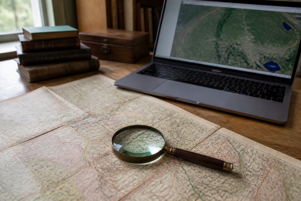
The Library of Congress map collections include thousands of searchable historical maps and atlases that document boundary changes and place name usage across the country.
Step 3: How to Track Place Name Changes Over Time
Place names change for reasons that range from the bureaucratic to the political. A town might be renamed when it receives a post office, when it is incorporated, or when a new wave of settlers arrives. Tracking those changes requires treating the name itself as a variable that shifts across time.
How to track place name changes begins with establishing a timeline. For each location, build a list of every name it has carried and the dates those names were in effect. The GNIS variant list gives you the raw names; the dates come from the records you find.
Use these methods to date a name change:
- Census records often list the county and town where a family lived. A change in the recorded name between census years signals a jurisdictional shift.
- Land records and deeds reference the county and state where the transaction was recorded, giving you a firm date for the administrative name in use.
- Post office records document when a community's post office was established, renamed, or discontinued, which frequently correlates with name changes.
- County formation dates are published in most state archives and tell you exactly when a new county was carved out of an older one.
State historical societies and archives publish county formation histories that are essential for this step. When you find a name change, record the date and the government action that caused it, then note the source in your documentation.
Step 4: Handle Non-English and Colonial Name Translations
The hardest verification problems involve places whose names were translated, transliterated, or replaced entirely when control of a region changed hands. A French fort, a Spanish land grant, and a British settlement might all refer to the same physical location under three different names. This is the default condition for much of the territory west of the Mississippi River and in the former French and Spanish colonies along the Gulf Coast and in the Southwest.
The first rule is to search in the language of the record, not the language of your family tree. If your ancestor's records are in German, search for the German name of the town, then cross-reference that against the modern name using a gazetteer that covers both. Many European gazetteers include cross-indexes between historical and current names.
A unique angle that most guides miss is the triangulation of colonial records against indigenous place names. When a Spanish land grant refers to "Rio de las Animas," and a later American survey calls it the "Purgatoire River," you must confirm that both refer to the same watercourse. But the verification is not complete until you also check for the indigenous name, often recorded in mission records or treaty documents. The U.S. Board on Geographic Names maintains a domestic names database that includes many names of Native American origin, but these are often the modern standardized spellings, not the historical variants.
For colonial records, understand that the colonizing power often renamed features that already had indigenous names. The mountain now known by one name may have had a Koyukon name for centuries before any European map was drawn. Recognizing this pattern helps you search for the earlier name in mission records, fur trade logs, or treaty documents. For example, the city now known as Chicago was recorded as "Chicagou" in French colonial documents, a phonetic rendering of the Miami-Illinois word for the wild leek that grew in the area. A researcher looking for French-era records must search for "Chicagou," not "Chicago."
When you encounter a translated name, do not assume the translation was exact. Colonial administrators frequently approximated local names phonetically, producing spellings that bear little resemblance to the original. The French "Oumiamis" for the Miami people, or the Spanish "Yumas" for the Quechan, are examples of phonetic approximations that became standard in official records. To verify these, you must work backward from the phonetic spelling to the likely original term, then cross-reference the geographic coordinates, not the name's meaning.
A practical workflow for colonial-era place verification:
- Identify the colonial power that created the record. This determines the language of the name and the archive where the record is held.
- Search the colonial power's own gazetteers, not just modern U.S. databases. The Library of Congress map collections include many colonial-era maps and atlases that show the names in use at the time.
- Look for the indigenous name in mission records, treaty texts, or ethnographic surveys. The Smithsonian Institution's Bureau of American Ethnology reports, many of which are digitized, are a rich source for these names.
- Compare the coordinates from the colonial map against the modern GNIS record. If the coordinates align, the names refer to the same place, regardless of the spelling difference.
- Document the chain of names in your research log, noting the language of each source and the date it was created.
National Archives research guidance on foreign records offers direction on locating and interpreting records written in other languages, including guidance on finding the original-language records of colonial administrations.
A common pattern in the Southwest is the layering of Spanish, Mexican, and American names over indigenous ones. The Gila River, for example, was known by various names to the Pima and Maricopa peoples before the Spanish arrived. A researcher tracing a family along the Gila must be prepared to search for the river under its Spanish name in mission records, its Mexican name in land grant documents, and its American name in post-1848 surveys. Each layer requires a separate search and a separate verification step against the physical geography.
Genealogy Location Verification in Practice
Genealogy location verification is the discipline of confirming that the place named in a record is the same physical location you are researching, even when the name, boundaries, or jurisdiction have changed. It is the difference between assuming and proving.
A practical workflow combines the digital and the archival:
- Record the place name exactly as it appears in the source document.
- Identify the jurisdiction named in that document, such as the county and state.
- Search GNIS for the modern equivalent and note any variant names.
- Consult a period map or gazetteer to confirm the location within the historical jurisdiction.
- Document the coordinates and the evidence chain that connects the historical name to the modern location.
The goal is a documented chain from the name on the original record to a set of geographic coordinates. Once you have coordinates, you can search modern databases with confidence, because you know the location is correct even when the name has changed.
Common Mistakes to Avoid in Place Name Research
Several recurring errors undermine otherwise careful research. The most common is assuming a modern county boundary matches the historical one. County lines have shifted constantly, and a location that sits in one county today may have been in two or three others over the past two centuries.
Another frequent mistake is relying on a single source for a name change. The U.S. Board on Geographic Names decision records show that name decisions are often contested and revised, so a name you find in one database may have been superseded. Cross-reference at least two independent sources before accepting a name as correct.
Researchers also overlook place name variations in spelling. Before standardized spelling, names were written as they sounded, so the same town might appear as "Smyth," "Smythe," and "Smith" in different records. Search engines are literal; you must account for variant spellings manually.
Finally, do not confuse a post office name with a town name. Communities often had a post office named after a nearby feature or a local resident, while the town itself carried a different name. The post office location is not always the town center.
| Research Task | Primary Tool | What It Confirms |
|---|---|---|
| Find official and variant names | GNIS database | Name recognition and coordinates |
| Confirm historical jurisdiction | Period maps and atlases | County and district boundaries |
| Date a name change | Census, deeds, post office records | When the new name took effect |
| Translate colonial records | Cross-indexed gazetteers | Equivalence across languages |
| Final verification | Multiple source comparison | Locational accuracy |
Conclusion: Document Your Geographic Evidence
Historical place name verification is not a single search. It is a habit of documenting every name, every boundary, and every jurisdiction you encounter, along with the source that proves each one.
Build a research log that records the place name as written, the date of the record, the jurisdiction named, and the source you used to verify it. This log becomes the backbone of your research, letting you return to any location and know exactly what you have proven and what remains uncertain.
At Correct Geography, we built our business on the principle that names carry meaning and history. Our Corrected Names Tee and Denali - The Great One Tee celebrate the names that predate political convenience, and our Gulf of Mexico - Since 1552 Tee honors nearly five centuries of a perfectly serviceable name. Each shirt is a small act of geographic documentation, a reminder that what a place is called matters.


The next time you find a place name in an old record, take the extra steps to verify it. The coordinates you confirm today will save you from a research dead end tomorrow. Get started with Correct Geography and wear the names that history gave us.
Frequently Asked Questions
How can I identify historical sources for location names?
Start with the U.S. Geological Survey GNIS database to confirm a place's official status and coordinates. Then, cross-reference that data with period-specific maps, county histories, and gazetteers from the era you are researching. Land deeds, census records, and military records often contain place descriptions that predate standardized spellings. Look for primary sources created closest to the event you are documenting, as they are less likely to reflect later name changes or boundary adjustments.
What is the difference between a gazetteer and a map for historical research?
A gazetteer is an alphabetical directory of places that lists geographic coordinates, jurisdictional affiliations, and often a brief history. A map shows spatial relationships but rarely explains why a name changed. For verifying historical place names, use a gazetteer to identify the correct place and its administrative divisions, then use a map to confirm its physical location relative to known landmarks. The GNIS database functions as a modern digital gazetteer for this purpose.
How do I handle name changes in historical documentation?
Record every name variant you find, along with the source and date for each. The GNIS database lists both the current official name and historical variants, which helps you connect records that use different names. When a county or town changed names, note the effective date of the change. For genealogy location verification, search all known variants to avoid missing records filed under an older jurisdiction or spelling.
Are there rules for naming places in the United States?
The U.S. Board on Geographic Names, part of the U.S. Geological Survey, maintains the official standards for geographic names. It resolves naming disputes and approves new names for federal use. Its Domestic Names Committee handles names within the country, while the Foreign Names Committee standardizes names of places overseas. The board's decisions are recorded in the GNIS database, which explains why official names sometimes differ from locally used or historically documented names.